

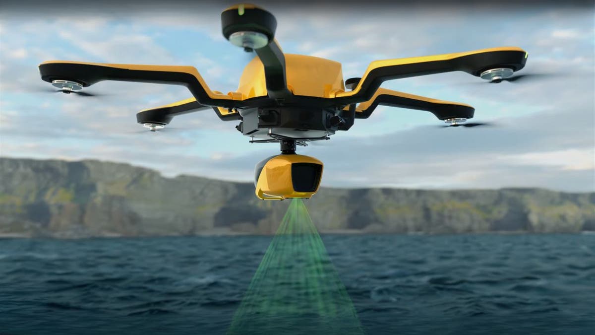
Picture yourself standing by a river, watching as a drone hums overhead.
Below, its lidar system scans the landscape, mapping both the land and the shallow waters with pinpoint accuracy. This is precisely what YellowScan’s new Navigator system is designed to do. Built specifically for mapping underwater topography in rivers, ponds and coastal areas, the Navigator is changing the game for environmental monitoring.
With precision where traditional methods struggle, it’s giving researchers and conservationists a whole new way to understand our planet’s changing waterways.
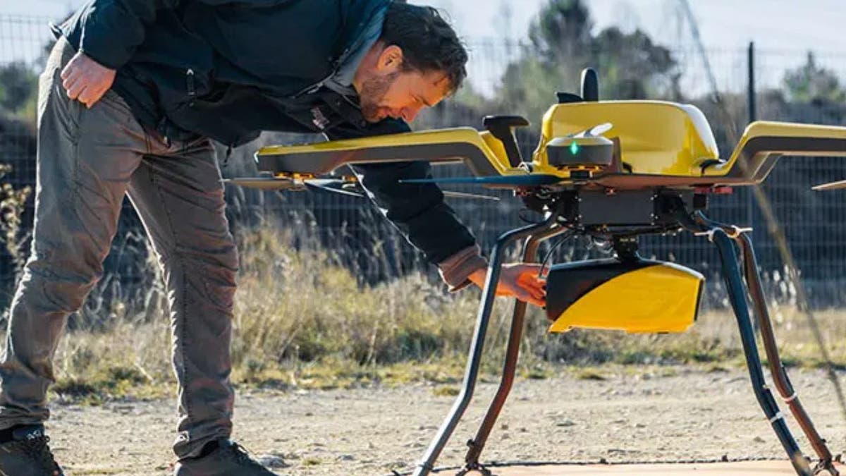
Navigator system (YellowScan)
Key features and specifications
The Navigator weighs approximately 8.16 pounds and is compatible with professional drones. In optimal conditions, it can map shallow waters up to 65.6 feet deep, producing digital models with an accuracy of approximately 1.18 inches. Key features include:
- Miniaturized high-precision sensor technology
- Suitability for mapping shallow waters where traditional techniques are unsafe
- Adaptive signal processing for challenging water conditions
- Integrated camera for true-color data visualization
- Up to 45 minutes of autonomy on a single battery charge
Navigator system (YellowScan)
AIR FORCE’S XQ-67A DRONE THINKS, FLIES, ACTS ON ITS OWN
Environmental applications
YellowScan emphasizes that the Navigator is a critical tool for addressing climate change impacts and advancing environmental research. Its applications include the following.
Tracking coastal erosion and sediment movement: The Navigator provides centimeter-level precision in mapping shorelines, enabling researchers to model erosion patterns and sediment transport more effectively. This data is vital for developing strategies to protect vulnerable coastal communities from flooding and habitat loss.
Monitoring underwater biodiversity habitats: By capturing detailed 3D images of underwater ecosystems, the Navigator allows scientists to assess habitat volume and spatial distribution. This capability is particularly useful for studying critical environments like eelgrass beds, which support marine biodiversity.
WHAT IS ARTIFICIAL INTELLIGENCE (AI)?
Assessing coral reef degradation: The system’s ability to map reefs in high resolution helps researchers monitor changes in coral health over time. This information is essential for identifying stress factors like bleaching events and guiding conservation efforts.
Evaluating sea-level rise impact zones: The Navigator enables precise mapping of low-lying coastal areas at risk from rising sea levels. By providing accurate elevation data, it supports planners in designing mitigation strategies and preparing for climate-induced migration.
Documenting changes in marine ecosystems: With its advanced lidar technology, the Navigator captures temporal changes in marine environments, offering insights into how human activity and climate change are reshaping aquatic ecosystems.
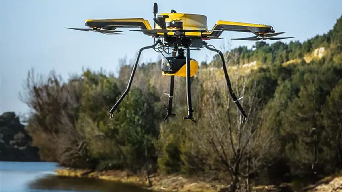
Navigator system (YellowScan)
AI-POWERED ATTACK DRONES TAKE FLIGHT
How the Navigator could transform key sectors
YellowScan highlights the Navigator’s potential to make a significant impact across various sectors. In environmental research, it enhances data collection, leading to more accurate environmental assessments. For marine conservation, the Navigator offers tools to better monitor and protect delicate marine ecosystems. When it comes to coastal protection strategies, it plays a crucial role in developing effective measures to combat erosion and flooding. The system also helps in climate migration planning by identifying vulnerable areas, enabling more informed decision-making. In infrastructure development, the Navigator aids in efficient planning by providing detailed spatial data. Finally, for scientific exploration, it offers researchers new ways to study and understand complex natural environments.
GET FOX BUSINESS ON THE GO BY CLICKING HERE
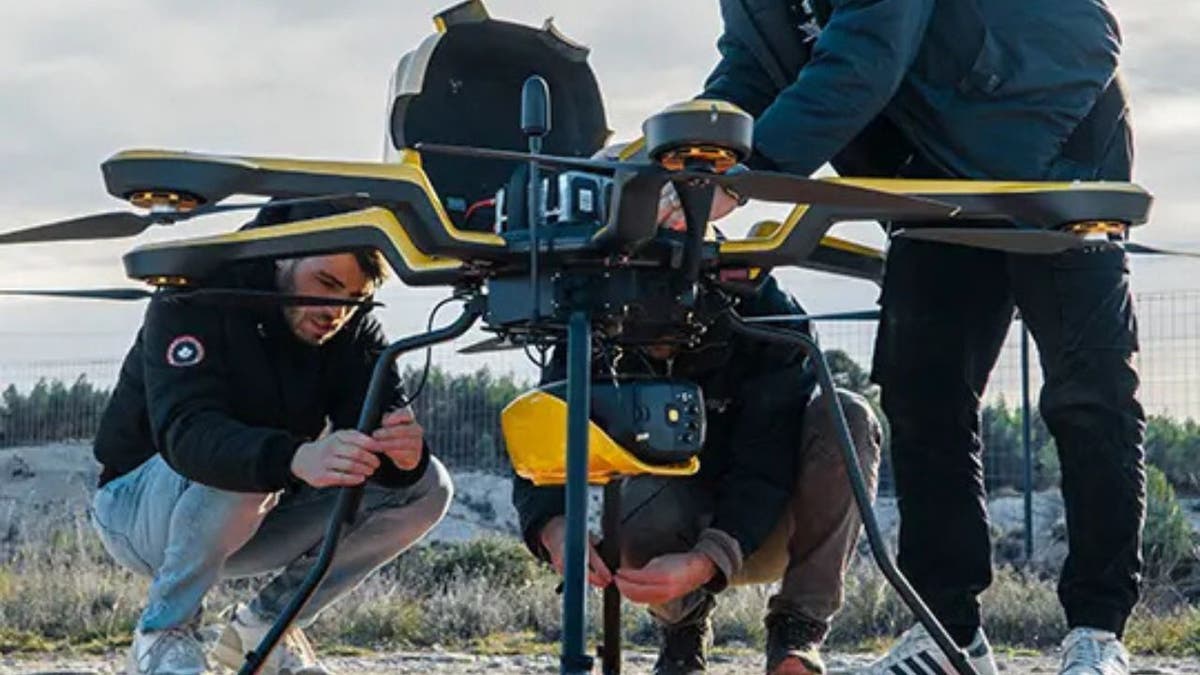
Navigator system (YellowScan)
ROBOTIC DRONES ARE REVEALING SECRETS ABOUT NATURE’S DEADLIEST HURRICANES
Cost of the Navigator
YellowScan hasn’t shared exact pricing for the Navigator yet, but given its advanced tech and precision, you can expect it to be a significant investment. That said, the long-term benefits, like better efficiency, lower operational risks and unmatched data accuracy, make it a smart choice for anyone in environmental research, infrastructure planning or marine conservation. For those interested, it’s best to reach out to YellowScan directly for custom pricing info.
HOW TO REMOVE YOUR PRIVATE DATA FROM THE INTERNET

Navigator system (YellowScan)
Insights from YellowScan’s CEO
YellowScan CEO Tristan Allouis says, “Years of development and distillation of knowledge were necessary to create YellowScan Navigator. This technology is transforming abstract climate change discussions into concrete, measurable data.”
SUBSCRIBE TO KURT’S YOUTUBE CHANNEL FOR QUICK VIDEO TIPS ON HOW TO WORK ALL OF YOUR TECH DEVICES
Kurt’s key takeaways
At the end of the day, the YellowScan Navigator isn’t just another fancy gadget; it’s a game changer for environmental research. Mapping shallow waters with this level of precision used to be nearly impossible, but now, scientists, conservationists and planners have a powerful new tool at their fingertips. Whether it’s tracking coastal erosion, monitoring marine habitats or preparing for rising sea levels, the Navigator is making complex problems a little easier to solve. And honestly, that’s the kind of tech we need more of.
CLICK HERE TO GET THE FOX NEWS APP
If technology can now map the unseen depths of our waterways with precision, what’s stopping us from taking stronger action to protect them? Let us know by writing us at Cyberguy.com/Contact.
For more of my tech tips and security alerts, subscribe to my free CyberGuy Report Newsletter by heading to Cyberguy.com/Newsletter.
Ask Kurt a question or let us know what stories you’d like us to cover.
Follow Kurt on his social channels:
Answers to the most-asked CyberGuy questions:
New from Kurt:
Copyright 2025 CyberGuy.com. All rights reserved.

